| Roads |
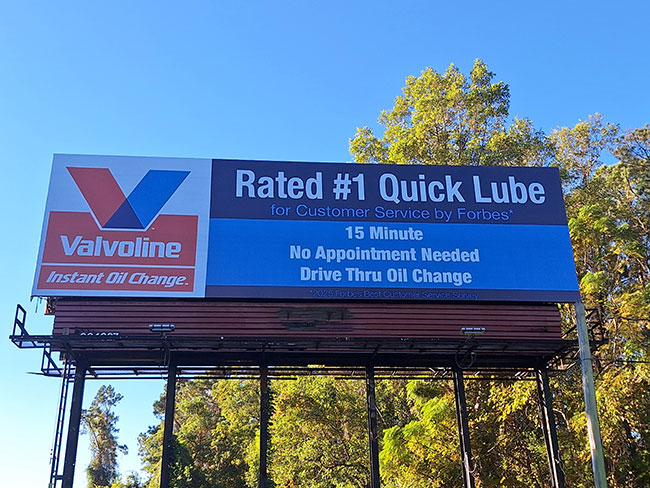
I-80 (Eastern Colorado / Nebraska / Wyoming Corridor) (44 faces) — The highest-density billboard corridor in the eastern Denver DMA, running east from Denver through the eastern Colorado plains toward the Wyoming and Nebraska state lines on the transcontinental interstate — reaching long-haul freight traffic, regional eastern Colorado commuters, and travelers crossing the far eastern edge of the DMA. I-76 (Commerce City / Fort Morgan / Nebraska Corridor) (31 faces) — The northeast Colorado interstate corridor, running from Commerce City and Denver’s northeast suburbs through Fort Morgan toward the Nebraska state line — reaching northeast Colorado commuters, oil and gas industry workers, agricultural businesses, and long-distance travelers on a relatively uncongested route through the eastern DMA. I-25 (Denver’s Front Range Spine) (13 faces) — Colorado’s primary north–south freeway, running from Fort Collins and Loveland through Longmont, Denver, Castle Rock, and south to Colorado Springs — the highest-traffic corridor in the state and the single most efficient billboard route for reaching the entire Front Range urban and suburban audience in one placement. I-70 (East-West Through Denver / Glendale / Aurora) (18 faces) — The primary east–west freeway through the Denver metro, running from the mountain resorts of Summit County and Vail through downtown Denver and the Denver International Airport corridor to the eastern plains — reaching Denver metro commuters, mountain-bound tourism traffic, and DIA airport travelers along the DMA’s most demographically diverse single corridor. Champa Street (Downtown Denver Core) (8 faces) — A primary one-way surface corridor through Denver’s Central Business District, running through the LoDo and Five Points neighborhoods near Coors Field and Ball Arena — reaching downtown Denver office workers, convention attendees, sports fans, and the dense LoDo and Five Points residential population with high-frequency pedestrian and vehicular exposure. Additional coverage on I-225 (Aurora–Tech Center), US-36 (Boulder Turnpike), US-6 (Golden–Lakewood), US-85 (Brighton–Greeley), C-470 (southwest beltway), US-285 (Littleton–Conifer), and Colfax Avenue (US-40) through Aurora and the East Colfax corridor. |
| Attractions and Neighborhoods |
Red Rocks Amphitheatre, Coors Field, Ball Arena, Empower Field at Mile High,
Denver International Airport, Denver Art Museum, Denver Museum of Nature & Science,
Colorado State Capitol, Denver Botanic Gardens, Denver Zoo;
LoDo (Lower Downtown), RiNo (River North Art District), Five Points, Capitol Hill,
Cherry Creek, Highland, LoHi (Lower Highlands), Baker, Auraria, Globeville,
Jefferson Park, City Park, Congress Park, Stapleton (Central Park),
Montbello, Park Hill, East Colfax, West Colfax, Sloan’s Lake, Sunnyside,
Whittier, Cory-Merrill, Washington Park, University, University Hills,
Platt Park, Harvey Park, Villa Park, Valverde, Lincoln Park, Golden Triangle;
Aurora, Lakewood, Arvada, Westminster, Thornton, Centennial, Parker,
Englewood, Littleton, Highlands Ranch, Commerce City, Brighton, Broomfield,
Castle Rock, Fort Collins, Boulder, Greeley, Loveland, Colorado Springs |